


97 Products showing for Remote Controls
In Stock
- RS Stock No. 146-3509
- Mfr. Part No. FOBLOQF-4S2
- Brand RF Solutions
- Frequency 433.92MHz
- Product Type Remote Control System
- Modulation FM
- Number of Channels 2
Subtotal (1 unit)
$111.28(exc. GST)
$111.28/unit

In Stock
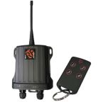
- RS Stock No. 762-309
- Mfr. Part No. TRAP-9R4
- Brand RF Solutions
- Frequency 918MHz
- Product Type Remote Control System
- Modulation LoRa
- Number of Channels 4
Subtotal (1 unit)
$264.24(exc. GST)
$264.24/unit
In Stock
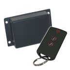
- RS Stock No. 146-3519
- Mfr. Part No. HORNETPRO-8S4
- Brand RF Solutions
- Frequency 868MHz
- Product Type Remote Control System
- Modulation FM
- Number of Channels 4
Subtotal (1 unit)
$217.79(exc. GST)
$217.79/unit

In Stock
- RS Stock No. 762-312
- Mfr. Part No. TRAP-9S4
- Brand RF Solutions
- Frequency 918MHz
- Product Type Remote Control System
- Modulation LoRa
- Number of Channels 4
Subtotal (1 unit)
$440.39(exc. GST)
$440.39/unit

In Stock
- RS Stock No. 146-3513
- Mfr. Part No. FOBLOQF-4T2
- Brand RF Solutions
- Frequency 433.92MHz
- Product Type Remote Key
- Modulation AM, FM
- Number of Channels 2
Subtotal (1 unit)
$57.19(exc. GST)
$57.19/unit
In Stock
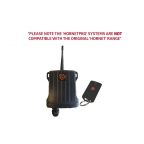
- RS Stock No. 181-3273
- Mfr. Part No. HORNETPRO-8S2M
- Brand RF Solutions
- Frequency 868MHz
- Product Type Remote Control System
- Modulation FM
- Number of Channels 14
Subtotal (1 unit)
$228.48(exc. GST)
$228.48/unit

In Stock
- RS Stock No. 146-3510
- Mfr. Part No. FOBLOQF-4S3
- Brand RF Solutions
- Frequency 433.92MHz
- Product Type Remote Control System
- Modulation FM
- Number of Channels 3
Subtotal (1 unit)
$103.13(exc. GST)
$103.13/unit
In Stock
- RS Stock No. 451-0315
- Mfr. Part No. 118C1A
- Brand RF Solutions
- Product Type Remote Control Base Station
- Sub Type Transmitter
- Frequency 433.92MHz
- Modulation AM
Subtotal (1 unit)
$152.76(exc. GST)
$152.76/unit
In Stock
- RS Stock No. 451-0337
- Mfr. Part No. 118C3A
- Brand RF Solutions
- Product Type Remote Control Base Station
- Sub Type Transmitter
- Frequency 433.92MHz
- Modulation AM
Subtotal (1 unit)
$157.28(exc. GST)
$157.28/unit
In Stock
- RS Stock No. 288-1492
- Mfr. Part No. ZBRRH
- Brand Schneider Electric
- Frequency 2405MHz
- Product Type Remote Control Kit
- Modulation O QPSK
- Number of Channels 1
Subtotal (1 unit)
$190.25(exc. GST)
$190.25/unit
In Stock
- RS Stock No. 146-3508
- Mfr. Part No. FOBLOQF-4S1
- Brand RF Solutions
- Frequency 433.92MHz
- Product Type Remote Control System
- Modulation FM
- Number of Channels 1
Subtotal (1 unit)
$118.84(exc. GST)
$118.84/unit
In Stock
- RS Stock No. 136-5936
- Mfr. Part No. RF Rx SW868 4S 24VDC
- Brand Steute
- Product Type Remote Control Base Station
- Sub Type Receiver
- Frequency 868.3MHz
- Number of Channels 4
Subtotal (1 unit)
$760.55(exc. GST)
$760.55/unit

Temporarily out of stock
- RS Stock No. 762-333
- Mfr. Part No. TAURUS-9T1
- Brand RF Solutions
- Frequency 918MHz
- Product Type Transmitter
- Modulation FM
- Number of Channels 1
Subtotal (1 unit)
$519.09(exc. GST)
$519.09/unit

In Stock
- RS Stock No. 146-3512
- Mfr. Part No. FOBLOQF-4T1
- Brand RF Solutions
- Frequency 433.92MHz
- Product Type Remote Key
- Modulation FM
- Number of Channels 1
Subtotal (1 unit)
$56.21(exc. GST)
$56.21/unit

Temporarily out of stock
- RS Stock No. 762-368
- Mfr. Part No. MULTILINK-8T1
- Brand RF Solutions
- Frequency 869.5MHz
- Product Type Transmitter
- Modulation LoRa
- Number of Channels 1
Subtotal (1 unit)
$159.57(exc. GST)
$159.57/unit

Temporarily out of stock
- RS Stock No. 762-366
- Mfr. Part No. SWITCHLINK-8S1IP
- Brand RF Solutions
- Frequency 868MHz
- Product Type Remote Control System
- Modulation FM
- Number of Channels 1
Subtotal (1 unit)
$240.06(exc. GST)
$240.06/unit

In Stock
- RS Stock No. 376-5110
- Mfr. Part No. 110C3-433A
- Brand RF Solutions
- Frequency 433.92MHz
- Product Type Remote Key
- Modulation AM, FM
- Number of Channels 3
Subtotal (1 unit)
$61.72(exc. GST)
$61.72/unit

In Stock
- RS Stock No. 762-319
- Mfr. Part No. RIoT23-RX-9R4
- Brand RF Solutions
- Frequency 918MHz
- Product Type RF Receiver
- Modulation FSK
- Number of Channels 4
Subtotal (1 unit)
$373.89(exc. GST)
$373.89/unit

In Stock
- RS Stock No. 762-369
- Mfr. Part No. MULTILINK-8R1
- Brand RF Solutions
- Frequency 869.5MHz
- Product Type Receiver
- Modulation LoRa
- Number of Channels 1
Subtotal (1 unit)
$159.57(exc. GST)
$159.57/unit

In Stock
- RS Stock No. 762-314
- Mfr. Part No. TRAP-9S1
- Brand RF Solutions
- Frequency 918MHz
- Product Type Remote Control System
- Modulation LoRa
- Number of Channels 1
Subtotal (1 unit)
$411.30(exc. GST)
$411.30/unit